Cyclone Vayu Weakens, Becomes a Deep Depression
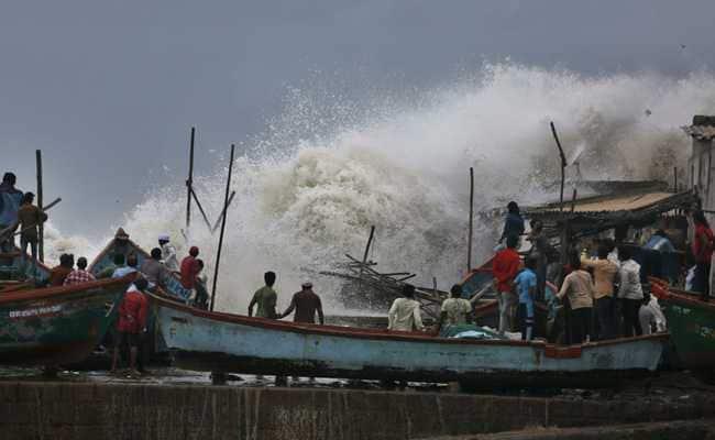
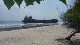
Image for representational use only.Image Courtesy : NDTV
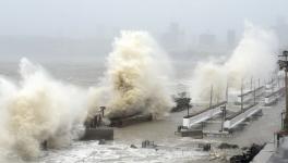
The extremely severe cyclonic storm Vayu, has been changing its course progressively. Initially, the weather department predicted that cyclone Vayu would make a landfall in Gujarat on Thursday, 13th June. However, due to a change in the course of the cyclone overnight, it did not make landfall in Gujarat. It skirted the Saurashtra coast and moved northwestward towards the Arabian Sea. Now, for the second time in a week, Vayu has again changed its course. However, the good news is that the cyclone has weakened and now it has transformed into a deep depression.
“Due to the Cyclone Vayu, Kutch along with nearby areas such as Saurashtra will receive heavy downpour for a couple of hours. Though the wind speed in these regions will not be very strong," Indian Meteorological Department (IMD) chief Jayant Sarkar was quoted as saying by news agency ANI. The storm, according to the IMD, will not cause much damage.
At midnight, it is predicted to cross the Gujarat coast as a depression. The forecast says that there will be heavy rains at isolated places in Saurashtra-Kutch region on Monday, and heavy to very heavy rains are predicted in North Gujarat and other districts in Saurashtra-Kutch on Tuesday.
The time and intensity forecast of the IMD is given in the following table:
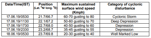
Table is taken from IMD website.
IMD has also produced the maps which include their observations and forecast the track of the cyclone in the Arabian Sea along with the wind distribution associated with the cyclone. We have enclosed these maps below.
The First map shows the forecasted track of Vayu over Northeast Arabian Sea and its neighboring area. The second Map shows the wind distribution associated with Vayu over the Northeast Arabian Sea.
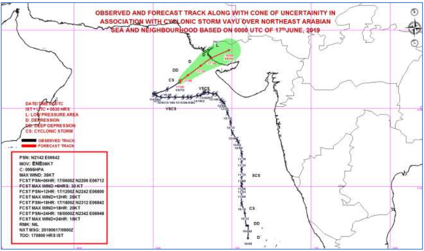
Map 1: forecast track of Vayu over Northeast Arabian Sea. Source: IMD.
The condition of the sea will remain very rough to high over northeast Arabian Sea and adjoining areas and by today evening, it is likely to become rough to very rough. Along and off Gujarat’s coast also, the condition of the sea is very likely to remain rough to very rough.
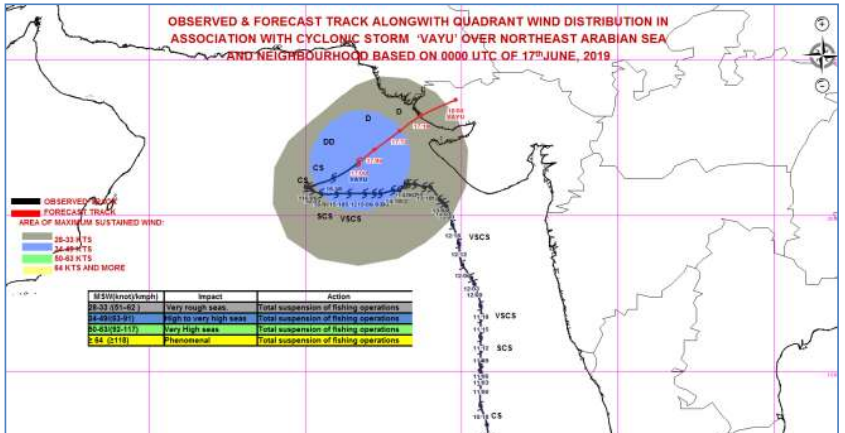
Map 2: wind distribution associated with Vayu. Source: IMD.
Extremely strong winds of speed ranging from 60 Km/hr to 80 Km/hr are blowing over northeast of Arabian Sea and the adjoining central Arabian Sea. The gust is likely to get weakened gradually and become 40 Km/hr to 60 Km/hr by tonight. From evening onwards, wind with this intensity are likely to blow along and off Gujarat’s coast.
Get the latest reports & analysis with people's perspective on Protests, movements & deep analytical videos, discussions of the current affairs in your Telegram app. Subscribe to NewsClick's Telegram channel & get Real-Time updates on stories, as they get published on our website.