Experts Suggest Ways to Prevent Floods in Konkan and Kolhapur
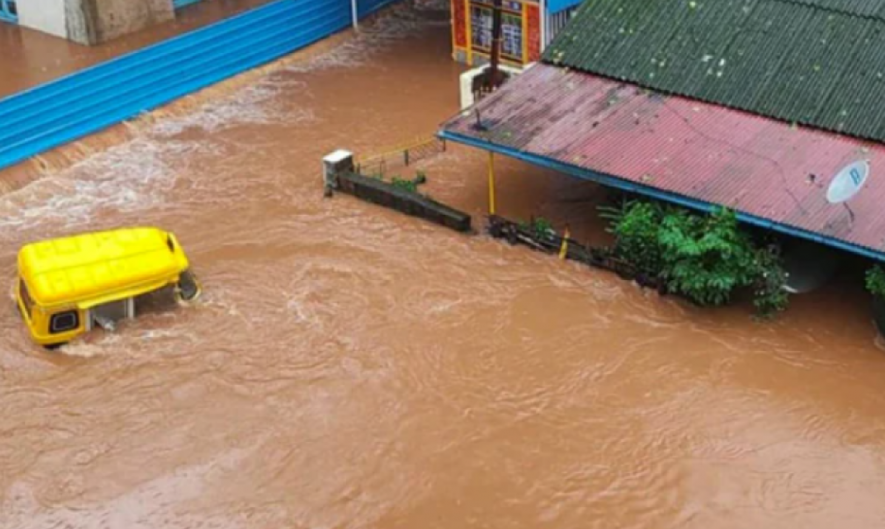
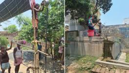
File Photo.
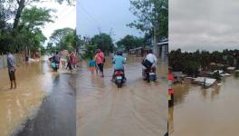
Maharashtra’s Konkan region and several other western parts—especially, Kolhapur and Sangali districts—are flooded every monsoon for the last five years. The inhabitants of this region live in constant fear of floods, which destroy lives and businesses.
After the August floods in Chiplun and Mahad cities of Ratnagiri and Raigad districts respectively (Konkan region), several environmentalists decided to conduct thorough scientific study to find the causes of the yearly floods and suggest solutions to mitigate their impact.
Jan Andolnanchi Sangharsh Samiti, headed by social activist Ulka Mahajan, took the lead and assisted experts in meeting the flood-affected residents of Konkan and Kolhapur and discussing the recurrent disaster. A committee headed by renowned flood expert Pradeep Purandare and comprising river, geology and architecture experts met the CEO and the SDO of Mahad and Chiplun and the commissioner and collector of Kolhapur district. A day-long seminar where representatives of the business community of Kolhapur and farmer unions was also held. After two months of discussions and meetings, a report was released.
The 50-page report suggests different schemes for every city. Mahad, in Raigad district, is situated on the banks of Savitri river, which has Kal, Gandhari, Kal Nala, Cholai, Nageshwari and Kharak tributaries. The Savitri river valley has 5,443 million cubic metre (m3) of surface water with 114 m3 available. However, out of the 5557 m3, the valley can only store 182.607 m3. Therefore, damns are not a solution to fix the problem of floods.
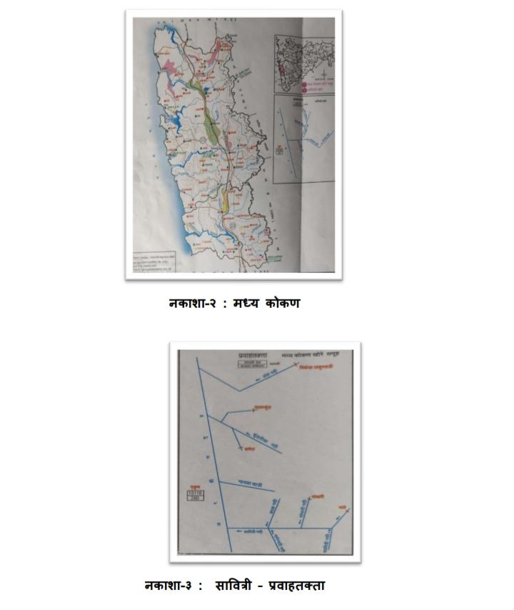
A downside part of the diagram of Savitri river and its tributaries.
Mahad had 209 mm of rainfall during July 20-25. The general flood line in Mahad is 5.75 metres, the danger line 6.5 metres and once in 25 years, the flood line reaches 8.6 metres. In July, the flood line was up to 8.2 metres. Mahad has a history of high-end floods. In 1923, 1976, 1989 and 1994, the flood line was reportedly as high as in 2021. Since all the tributaries of Savitri river meet in Trellis pattern, the possibility of floods increases.
The committee, which found that higher rains, the garbage dumped in Savitri by the Konkan railway contractor and illegal buildings along the river as the main reasons for the floods, gave six important suggestions. There are two islands in river 1-3, 1-4. The panel suggested digging and shifting these islands out of the river to maintain the water flow. It has asked the revenue department to allow dredging. The committee also suggested to immediately cease construction till 8.6 metres near the river front and clean the nullah regularly.
“We have suggested the most important process of dredging in Mahad as well as Chiplun, which will help minimise the effects of floods. But dredging must be done under the vigilance of local irrigation and revenue authorities,” Purandare said.
Chiplun was inundated during July 21-23. There were talks of shifting the city from the banks of Vashishti river. The committee has opposed the idea. “Shifting is the last option. There are other options. The government must immediately focus on those,” the report states.
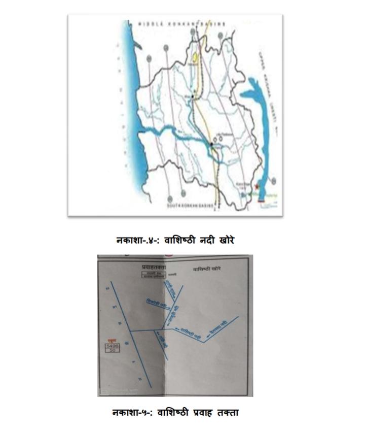
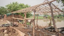
Vashisti valley river and a diagram of the river and its tributaries.
The experts suggested demolishing the old bridge on the river at Pethmap and building six damns of thousand million cubic feet each on Sahyadri side of Vashishti. It will help manage floods as well as irrigation, the report suggested.
The committee also suggested dredging of the river and its tributary Shiv Nadi and discussions with Chiplun citizens before taking any decision on shifting the market.
Raigad, Ratnagiri and Sindhudurga are three districts in the Konkan region which are on the west side of Sahyadri Mountain. Kolhapur is on the east side. The gradual destruction of the Western Ghats has become a serious problem. The Western Ghats Ecology Expert Panel, also known as the Gadgil Commission after its chairman Madhav Gadgil, released its report in August 2011, alerting about floods and landslides. The landslide at Taliye village, under Mahad tehsil of Raigad, which killed 89 people in July, was a very serious warning. The committee has discovered several similar places with a serious possibility of landslides.
“Shifting the people from these places to safer places is the only way to prevent major damage. But it is not enough. Continuous actions such as tree cutting and allowing building work in deep Sahyadri are the major mistakes. This must be stopped at all costs. The Gadgil committee report is with the Central government. It should be implemented with the consultation of local authorities,” the report stated.
River rejuvenation is a very important step towards preventing floods. Be it Vashishti of Chiplun or Panchganga of Kolhapur, they need immediate attention. The committee has asked the government to come up with a detailed plan for Panchganga, including dredging, to finalise and strictly follow the flood line.
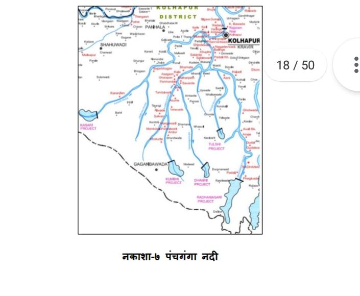
A map of Panchganga river.
“We are going to start a campaign based on this report. We will take it to people, make them aware of the danger of environmental changes and also pressure the state government to follow the suggestions in this report. The battle to save Sahyadri and maintain the lives and properties of people staying on either side is huge and very important,” Mahajan told Newsclick.
Get the latest reports & analysis with people's perspective on Protests, movements & deep analytical videos, discussions of the current affairs in your Telegram app. Subscribe to NewsClick's Telegram channel & get Real-Time updates on stories, as they get published on our website.