Feb 7 Chamoli Disaster was Caused by Massive Rock and Ice Avalanche: Study
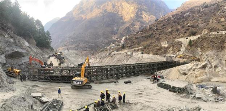
New Delhi: The February 7 disaster in the Chamoli district of Uttarakhand, that resulted in over 200 dead or missing, was the result of an avalanche that dropped about 27 million cubic metres of rock and glacier ice from the nearby Ronti Peak, according to a study by an international team of researchers.
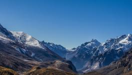
The region experienced a humanitarian tragedy on February 7 this year, when a wall of debris and water barrelled down the Ronti Gad, Rishiganga and Dhauliganga river valleys.
To investigate the cause, scope, and impacts of the disaster, a global team of 53 scientists came together in the days following the tragedy.
The researchers, including those from Jawaharlal Nehru University in New Delhi and Indian Institute of Technology Indore, determined that the flood was caused by falling rock and glacier ice that melted on its descent, and not by a lake or diverted river.
The study, published in the journal Science on Thursday, suggests that climate change is contributing to such events happening more frequently, and highlights risks of increasing development projects in fragile environments.
The rock and ice avalanche rapidly transformed into an extraordinarily large and mobile debris flow that transported boulders 20 metres in diameter, and scoured the valley walls up to 220 metres above the valley floor, the researchers said.
The finding will help researchers and policymakers better identify emerging hazards in the region.
The study used satellite imagery, seismic records, and eyewitness videos to produce computer models of the flow.
Initial hypotheses for the cause of the event suggested a glacial lake outburst flood.
However, there are no glacial lakes large enough to produce a flood anywhere near the site, the researchers noted.
"Our access to high-resolution satellite imagery and research software, and our expertise in satellite remote sensing were crucial to get a bird's-eye view of how the event unfolded," said study co-author Shashank Bhushan, a doctoral student at the University of Washington in the US.
"We worked with our French collaborators to coordinate satellite collections within days of the event and rapidly process the images to derive detailed topographic maps of the site," Bhushan said.
The team compared the images and topographic maps from before and after the event to document all of the changes and reconstruct the sequence of events.
"We tracked a plume of dust and water to a conspicuous dark patch high on a steep slope," said study lead author Dan Shugar, associate professor at the University of Calgary in Canada.
The dark patch turned out to be the scar left by the 35 million cubic yards of missing rock and glacier ice with a three-foot-deep layer.
"This was the source of a giant landslide that triggered the cascade of events, and caused immense death and destruction," said Shugar.
The researchers also used the maps to determine how far the block of ice and rock fell.
"The failed block fell over a mile before impacting the valley floor. To put this height in context, imagine vertically stacking up 11 space needles or six Eiffel Towers," Bhushan said.
The team also quantified how the pulverised rock and ice were redistributed over the downstream areas.
"As the block fell, most of the glacier ice melted within minutes. This resulted in a huge volume of water associated with the flooding,” Bhushan said.
"This is highly unusual -- a normal rock landslide or snow/ice avalanche could not have produced such huge volumes of water," he explained.
The team also used satellite image archives to show that previous large ice masses had been dislodged from the same ridge and struck the same valley in recent years.
The researchers suggest that climate change is likely increasing the frequency of such events, and that the greater magnitude of the latest disaster should be considered before further infrastructure development in the area.
"These high-mountain rivers are appealing for hydropower projects, and we need a better understanding of the full spectrum of potential high-mountain hazards," said David Shean, a University of Washington assistant professor.
"We hope that lessons learned from this effort will improve our ability to respond to future disasters and guide policy decisions that will save lives," he added.
Get the latest reports & analysis with people's perspective on Protests, movements & deep analytical videos, discussions of the current affairs in your Telegram app. Subscribe to NewsClick's Telegram channel & get Real-Time updates on stories, as they get published on our website.