Are There Mountains Deep Inside The Earth?
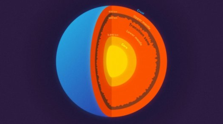
Image Courtesy: Science Daily. Image is for representational use only.
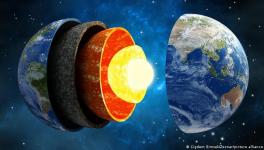
Almost 660 kilometers deep inside the earth, there could be mountains and other topographies, a recent study published in Science magazine suggests. The combined study done by geophysicists of Princeton University, Jessica Irving and Wenbo Wu, with Sidao Ni from the Institute of Geodesy and Geophysics in China, analysed the data from a massive earthquake in Bolivia. They found that the layer that separates the upper and lower mantle at 660 km from the surface has got mountains and other similar topographical structures. The mountains at this depth may be bigger than anything else on earth’s surface. The researchers also analysed the region at the top of the transition zone—410 km down, but did not find any roughness.
To get information from deep inside the earth, scientists use the most powerful waves on the planet—those generated by massive earthquakes. Big earthquakes of magnitude 7.0 or more on the Richter scale are capable of transmitting shockwaves in all directions. These shockwaves are so penetrating that they can pass through the solid core of the earth and can reach other side of the planet and back again. For the current study, the team got their data from the waves generated by a mammoth quake that rocked Bolivia in 1994.
The shock wave data were analysed using powerful computers, like that of Princeton’s Tiger supercomputer cluster. The computation involved the simulation of waves to decipher the hidden information these had. The technique makes use of a fundamental property of waves, that is their ability to bend and bounce back similar to light waves which can bounce back from a mirror or bend when passing through a different media as through a prism. This bending of light waves is called refraction and the bouncing back is termed as reflection. Earthquake waves, when they encounter a rough surface in its path, can get reflected or refracted.
“We know that almost all objects have surface roughness and therefore scatter light," said Wu, the lead author on the new paper to Science Daily. "That's why we can see these objects -- the scattering waves carry the information about the surface's roughness. In this study, we investigated scattered seismic waves traveling inside the Earth to constrain the roughness of the Earth's 660-km boundary."
The researchers were astonished from the results of the analysis of the waves. The waves penetrated through the core of the earth and encountered in rough surfaces, rougher than the surface layer that we all live on. “In other words, stronger topography than the Rocky Mountains or the Appalachians is present at the 660-km boundary," said Wu.
The statistical model developed in the study did not give a clear picture about the precise height of the mountains deep inside the earth. Nevertheless, they envisage that these mountains are bigger than anything that we see on the surface of the earth. Moreover, the roughness was not smooth at all, they have rough surfaces and plain patches in between—like that of mountains.
What Significance does this finding have?
The presence of roughness inside the earth has significant implications on how the planet was formed and endures to function. The layer at a depth of 660 km where the mountain-like roughness was found divides the mantle—which constitutes 84% of the earth’s volume into upper and lower sections. Geoscientists, for years, have been debating the importance of this layer in terms of heat transmission through it. While some geochemical and mineralogical evidences indicate that these sections of the mantle are physically and thermally different, other observations suggest that these two sections are not different in anyway and are well-mixed.
This new finding suggests that both the previous findings might be partially right. The smoother parts of the 660-km boundary could be the result of a thorough vertical mixing, while the mountainous areas might have formed where the two sections don’t mix well.
Get the latest reports & analysis with people's perspective on Protests, movements & deep analytical videos, discussions of the current affairs in your Telegram app. Subscribe to NewsClick's Telegram channel & get Real-Time updates on stories, as they get published on our website.