'Forgotten People': Sundarbans' Climate Refugees Forced to Move Again
People in the Sundarbans delta have always lived with the whims of the water but in recent times violent storms and rising sea levels have made life increasingly difficult
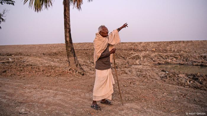
For over a year, Gangadhar Bor has planned his life around the rising tide. Each full moon, he moves from his tin-roofed, one-room brick home to a makeshift hut of bamboo and tarpaulin raised a few meters above the ground.
With the high tide, the Muri Ganga River breaches the embankments that are supposed to protect Bor's village of Bankimnagar, on the coast of Sagar Island. Water surges in a hundred meters, and villagers must wait for it to recede before they can return home.
"It is now a way of life," Bor says.
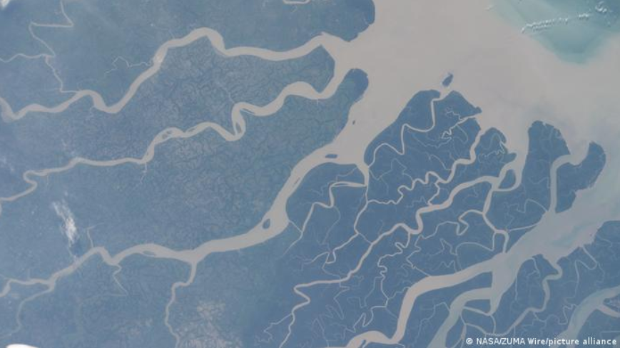
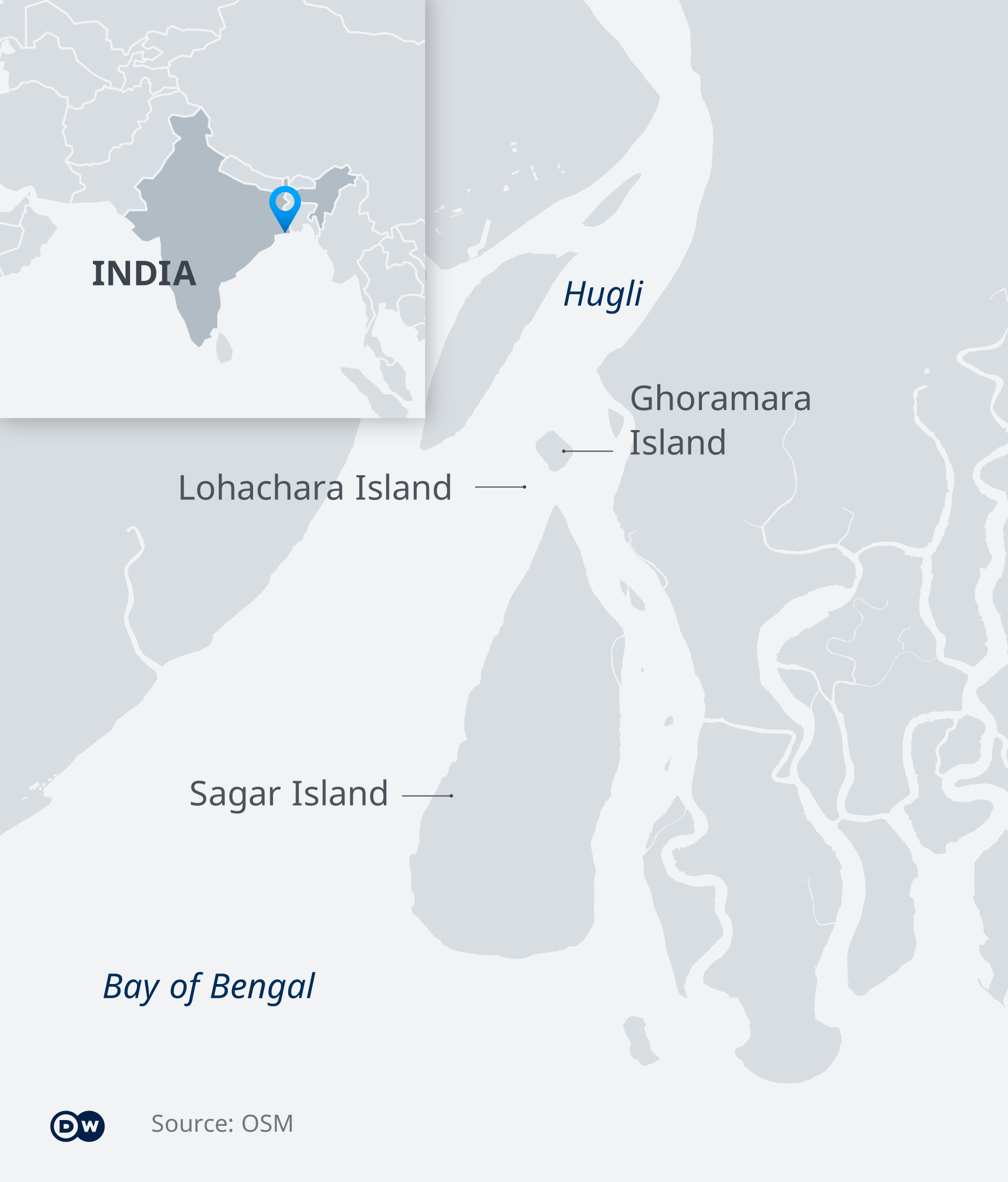
Sagar Island lies at the western end of the Sundarbans, where the Ganges, Brahmaputra and Meghna rivers converge, and smaller tributaries lace the world's largest mangrove forest. Covering a total area of 40,000 square kilometers (15,444 square miles), the delta stretches across Bangladesh in the east and the Indian state of West Bengal in the west.
Sagar is the largest of the delta's Indian islands, with a population of more than 200,000 and growing. As rising tides and numerous storms make smaller neighboring islands virtually uninhabitable, it has become home to many climate refugees, like 65-year-old Bor.
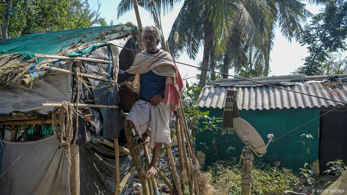
Each full moon, Bor, 65, has to move from his house to a makeshift hut on stilts as water floods his home
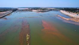
But Sagar Island is itself now under threat. Over the last two decades, the sea level in the delta has risen by 3 centimeters (1.2 inches) a year on average. That's much faster than elsewhere in the world. Sagar has already lost around 50 square kilometers of land — around a sixth of its former area — to coastal erosion.
A haven that's no longer safe
Bor fled to Sagar from Lohachara Island in the late 1980s as the delta waters encroached on his home. It was a wrenching move.
"We wanted to stay back as we had a steady earning catching fish," he recalls. "But every other year we had to move in a little and build a new house as the island shrunk a little more. Finally, after surviving many storms and floods, we gave up."
Lohachara was completely submerged in 1996.
Now he and others in his community living on the southern edge of the island are facing the same problem that forced them to leave their previous home.
When he first arrived on Sagar, Bor says the river would sometimes breach its embankment, but monthly floods on the high tide are a new experience.
While homes can be mopped out each month, the farmland the community relies on is not as easily restored.
Bor's land is now permanently awash with the river's saline water. But just two years ago, he was still growing betel, a stimulant popular in south Asia, on a two-acre plot behind his brick house.
In that time, two major cyclones have pushed the Sundarbans deeper into crisis.
Shoring up a fragile coastline
In 2020, cyclone Amphan destroyed about a quarter of the delta's Indian mangrove forest. Mangroves are a natural bulwark against coastal erosion and a rough water.
Amphan, and cyclone Yaas, which hit the Sundarbans the following year, also damaged the brick and earth embankments that had protected many parts of the island for over three decades.
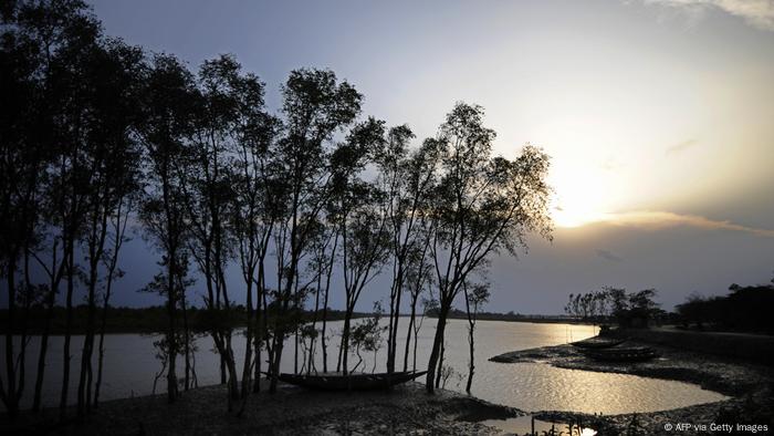
Sundarbans is the largest mangrove forest in the world and is home to unique wildlife, including tigers. The mangroves provide a buffer against storms
Sunil Jana, a member of the 'panchayat', an elected village governance body, says repairs have begun on 200 meters of damaged embankment in Bankimnagar. But work is slow.
"The entry of saline water has to be stopped first for any improvement of our situation, and for that we need a strong embankment," says Jana.
Apart from the immediate repair work, the West Bengal state government has approved another comprehensive plan for a new "circuit" embankment consisting of two layers of dikes and mangroves for particularly vulnerable sides of the islands.
However, there is no official timescale for the project, and the plan itself estimates that building it could take 10 years.
Those living on water's edge don't have that kind of time. Should another cyclone hit before the circuit embankment is ready, around a thousand people could lose their homes, says Sugata Hazra, a professor at the School of Oceanographic Studies at Jadavpur University in Kolkata.
Village council member Sunil Jana says more needs to be done to repair the embankments protecting the village from water surges
Climate refugees move on once more
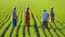
Life in the Indian Sundarbans, where some 43% live below the poverty line is already tough. Most survive from subsistence agriculture, as well as fishing and honey collection.
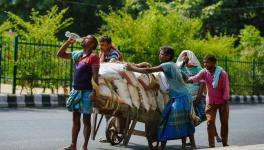
Droves of young men and women have had to leave Sagar for Kolkata — the nearest city — or for states like Kerala and Andhra Pradesh over 1,000 kilometers away. There they face a precarious existence as daily wage laborers and contract workers at construction sites and factories.
Many of those still here want to leave, yet in contrast to the relocation programs that brought them to Sagar in the 1980s and 1990s, there is no sign of any government assistance to make this happen.
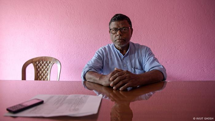
Mohan Kumar Bera, a social scientist at the Birla Institute of Technology and Science, says the Indian government must come up with a coordinated plan to help people whose homes are in vulnerable zones to relocate. This also needs to be coupled with means and training for alternative employment to adapt to life on an island where traditional agricultural livelihoods are becoming impossible.
"Unaided migration in the face of a crisis leaves the people many times more vulnerable than when they move in a group and with some kind of social support," he says. "We need forward-looking policies on cluster resettlement or training for alternate modes of employment so that they are less dependent on the land."
Yaas Bishnupada Bhunia in his 70s points at an embankment. He says he's seen the water come ever closer over the course of his life
Bor says he would move again if he could. But he isn't hopeful of receiving the support he would need to build a new life.
"I really don't see any help coming. We are a forgotten people," he laments.
Life in limbo
For others, the prospect of fleeing a second time is more than they can countenance. Uttam Dolui, aged 55, arrived on Sagar from the inundated island of Ghoramara 20 years ago.
Dolui explains that when he first moved, they had little food, and no work because people were suspicious of refugees.
"They would even not allow us to visit their homes," he says. "Things have changed here now. But I never want to go through that again."
Meanwhile, those displaced from other parts of the delta keep arriving in Sagar. Before cyclone Yaas, the government temporarily evacuated a few thousand people from neighboring islands.
Many have since gone back to their homes, and some have moved on to mainland cities in search of work. Others remain in limbo in Sagar, uncertain of what the future holds.
Edited by: Ruby Russell
Get the latest reports & analysis with people's perspective on Protests, movements & deep analytical videos, discussions of the current affairs in your Telegram app. Subscribe to NewsClick's Telegram channel & get Real-Time updates on stories, as they get published on our website.