Monsoon Hits Kerala; North India Likely to Receive Above Normal Rainfall
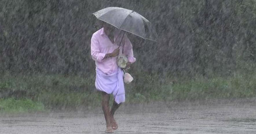
Image Courtesy: Sky Weather
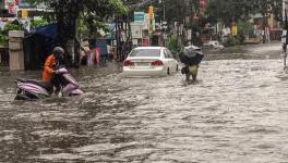
New Delhi: The Southwest monsoon hit Kerala on Monday on its normal onset date, marking the commencement of the four-month-long rainfall season, the India Meteorological Department (IMD) said on Monday.
North India is likely to get "above normal" rainfall, while Central India and the Southern Peninsula will receive "normal" rainfall. However, East and Northeast India are likely to receive less rainfall than other parts of the country, according to the IMD.
"The Southwest monsoon has made an onset over Kerala," IMD director general Mrutyunjay Mohapatra declared as widespread rainfall occurred in the Southern state during the past two days.
The country receives 75% of its rainfall from the Southwest monsoon during June to September. It is not only crucial for farming in the country, but also for replenishing the reservoirs, and more importantly to the economy which is still largely dependent on agriculture.
Overall, the country will receive normal precipitation with a Long Period Average of 102% with an error margin of plus or minus 4%, M Rajeevan, secretary, Ministry of Earth Sciences, said at a media briefing on the second long range forecast for the 2020 Southwest monsoon rainfall.
In its first long range forecast for monsoon 2020 released in April, the IMD had said the rainfall will be 100% of the LPA.
There is 41% possibility that the country will receive "normal" rainfall and just 5% possibility of "deficient" rainfall, Rajeevan added.
The monthly rainfall over the country as whole is likely to be 103% of its LPA during July and 97% of LPA during August with a model error of plus or minus 9%.
The LPA for the period 1961-2010 is 88 centimetres. LPA between 90-96% is considered as "normal" rainfall. It is considered as "above normal" if the rainfall range is between 104-110%; "excess" if it crosses 110 per cent and "deficient" if it is below 90%.
The IMD has four meteorological subdivisions Northwest India, Central India, Southern peninsula and East and Northeast India.
The Northwest India subdivision comprising states of Himachal Pradesh, Uttarakhand, Punjab, Haryana, Rajasthan, Uttar Pradesh, union territories of Jammu and Kashmir, Ladakh, Delhi and Chandigarh will receive 107% of the rainfall with an error margin of plus or minus 8%. This falls under the "above normal" category.
The Central India subdivision will receive 103% of the LPA, which borders the normal and above normal parameter. The central India subdivision covers states of Goa, Maharashtra, Gujarat, Madhya Pradesh, Chhattisgarh and Odisha.
The Southern peninsula is likely to receive 103% of the LPA. The Southern peninsula subdivision consists of Kerala, Puducherry, Tamil Nadu, Karnataka, Andhra Pradesh and Telangana.
However, the East and Northeast subdivision will receive 96% of the rainfall which borders the normal and below normal category. This subdivision covers all the Northeastern states besides West Bengal, Jharkhand, and Bihar.
"Currently, ENSO (El Nino) neutral conditions are prevailing over the equatorial Pacific and neutral IOD (Indian Ocean Dipole) conditions are prevailing over the Indian Ocean.
"Global models indicate cool ENSO conditions are likely to prevail during the monsoon season with some possibility of development of weak La Nina conditions in the later part of the monsoon season," the IMD said.
La Nina is associated with cooling of Pacific waters and is believed to have a positive impact on the Indian monsoon. Indian Ocean Dipole is associated with heating (negative IOD) and cooling (positive IOD) of the Indian Ocean waters.
Private forecaster Skymet Weather had on May 30 declared the arrival of monsoon, but the IMD had differed, saying the conditions were not ripe.
According to the IMD, there are three major conditions to declare the onset of monsoon.
The first is, if, after May 10, 60% of the 14 weather stations -- Minicoy, Amini, Thiruvananthapuram, Punalur, Kollam, Allapuzha, Kottayam, Kochi, Thrissur, Kozhikode, Thalassery, Kannur, Kudulu and Mangalore -- report rainfall of 2.5 millimetres or more for two consecutive days, the onset over Kerala will be declared on the second day.
The second is the depth of westerlies should be maintained up to 600 hectopascals (hPa) and the third is the Outwave Longwave Radiation should be below 200 watt per square metre (wm-2).
Mohapatra said more than 70% of the 14 rainfall monitoring stations for monsoon onset over Kerala have reported rainfall during last 48 hours.
"Westerly winds have strengthened in the lower levels (wind speed up to 20 knots) and deepened up to 4.5 kilometres over the south Arabian Sea and there is persistent convection (cloudiness indicated by Outgoing Longwave Radiation values and 200 Wm-2) from satellite imagery and coastal Doppler Weather Radars from May 27 onwards," he said.
"As the conditions have been met, we have declared arrival of monsoon over Kerala," Mohapatra added.
Get the latest reports & analysis with people's perspective on Protests, movements & deep analytical videos, discussions of the current affairs in your Telegram app. Subscribe to NewsClick's Telegram channel & get Real-Time updates on stories, as they get published on our website.