Despite Mishaps on Himalayan Range, No Geological Study for 500-MW Dugar HEP
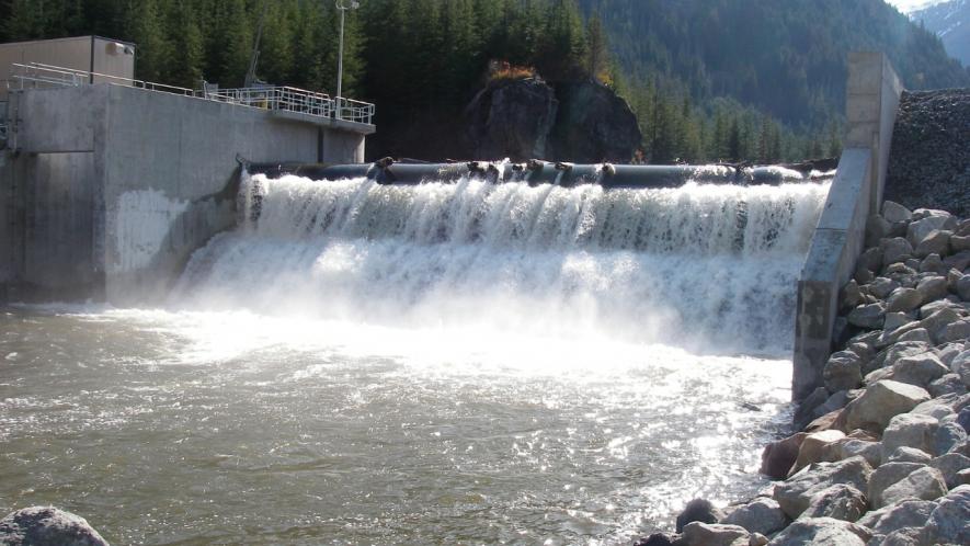
Representational image. | Image courtesy: Wikimedia Commons
New Delhi: Despite major accidents resulting from environmental oversight in the execution of infrastructure works on the Himalayan range, no geological study has been conducted for the proposed Dugar hydroelectricity project in Himachal Pradesh. The 500 Mega Watt (MW) project is proposed in the basin of the Chenab River in Chamba district, amidst dense forests and mountains that are susceptible to landslides.
Public sector hydropower company NHPC Limited is executing the Rs 5,400-crore project as per an MoU signed with Himachal Pradesh government in September 2019. Local people claim they have not given their consent for the project because it will result in loss of livelihoods of forest-dependent communities and increase the possibility of landslides.
“The government has promised temporary employment for around 2,500 people during the project’s construction phase. It has promised permanent employment for around 250 persons once the project is fully operational. But it has not clarified as to how many of these jobs will be reserved for the local population,” said Pawan Kumar, a resident of Pangi tehsil.
Chamba is placed fourth amongst all districts of Himachal Pradesh in terms of severity of exposure to landslides vis-à-vis socio-economic factors like population, number of households and livestock. Overall, the district is placed at 32nd position in the country in terms of landslide exposure.
The project is spread over an area of 220.62 hectares in Luj village of Chamba, out of which 211.85 hectares are forests. At least 25 villages are located within a 10-km radius of the project site. The project will impact 121 individual land owners who have been identified for the acquisition of 8.78 hectares of private land. No households will be displaced, however.
A proposal to clear the forests is pending for clearance before the Forest Advisory Committee (FAC), which advises the Union Ministry of Environment, Forests & Climate Change (“the ministry”) on the impacts of forestland diversion for industrial projects. Apparently, local communities have raised no claims over the forest land that is sought to be diverted. “A thorough investigation needs to be conducted as to whether local people have actually not raised claims over the forestland,” added Kumar.
Water from streams flowing into the Chenab – many of them will be obliterated – is used for irrigation purposes. But the project proponent has claimed that farming activities will not be impacted by the project. “Farming land is available downstream of the project which is situated at a higher elevation from the river. The water of the river Chenab is not being used for farming because the farms are situated at a higher elevation from the river,” NHPC Limited has told the ministry.
Nevertheless, the possibility of landslides resulting from the Dugar project is haunting local communities. The central government carried out a protracted environmental impact assessment of the project between 2020 and 2022. But no geological studies were included in it. The Expert Appraisal Committee (EAC), an expert body which critically evaluates potential environment impacts of industrial projects on behalf of the ministry, cleared the proposal on August 29, 2023 subject to the condition that forest clearance is granted to the project.
The proposal seeking forest clearance was submitted to the ministry in July 2022. However, at least a couple of accidents which took place this year – at Silkyara tunnel collapse and Teesta III dam washout in Uttarakhand and Sikkim, respectively – brought into sharp focus the need to conduct holistic environmental studies for infrastructure projects on the Himalayan range.
The FAC advised NHPC Limited to carry out a study through the Wadia Institute of Himalayan Geology, an autonomous government-run institute based in Dehradun, to ascertain the geological fragility, if any, of the project site. But, NHPC Limited rejected the advice saying that it already has the consent of the Geological Survey of India. It also said that the project report has been vetted through agencies including the Central Electricity Authority, Central Water Commission and the National Committee on Seismic Design Parameters.
“… the Geological aspects of Dugar HEP [hydro-electricity project] have been reviewed in detail by Geological Survey of India (GSI) during DPR [detailed project report] examination stage and GSI has accorded clearance to the project after holistically evaluating the geo environment and geological stability of the project area … new study by any other agency may not be prudent as the sufficient geological investigations and studies have been done already in this regard,” reads a letter from NHPC Limited that was sent to the ministry on November 9, 2023.
Several landslides have rocked the region around the proposed Dugar project in the recent past.
A series of landslides at the under-construction Ratle hydroelectric project on the Chenab River in Kishtwar district of Jammu and Kashmir in October 2022 had left at least four people dead and several others injured. The landslides hit the area while construction activities were underway for building a link road to the hydropower project. The 850-MW project is located less than 100 kms away from Dugar.
In February 2023 at least 300 people were evacuated and nearly two dozen houses emptied following an incident of earth subsidence, in the nearby Doda district of Jammu & Kashmir. Doda is, again, within a 100-km radius of the Dugar project site.
Though NHPC Limited has refused to go for a study by the Wadia Institute of Himalayan Geology, the ministry has time and again depended on the institute’s data regarding the geological fragility of North Indian states. Recently, while responding to a question in the Lok Sabha on risk-mapping of hilly areas, the ministry quoted a study by the institute to arrive at the conclusion that high to very high landslide susceptible zones covers 25-30 per cent area of Himachal Pradesh.
The ministry went on to state in its reply that as per Himachal Pradesh government, about 32 per cent of the state’s total geographical area is categorised as “Very High Damage Risk Zone (Zone-V)” in the seismic map of India. “ … Higher Hills comprising the districts of Kinnaur, Lahaul and Spiti, Chamba, and Kullu are particularly vulnerable to avalanches as reported by the State Government of Himachal Pradesh,” the ministry stated in the reply dated 18 December.
The Dugar project is one of the 20 “large” water-turbine power plants cleared for construction in the basin of the Chenab River. Despite the geological fragility of the Chenab River basin, a Cumulative Environmental Impact Assessment Study of hydropower projects, carried out under the aegis of the ministry in 2016, had recommended the construction of the Dugar project.
The additional proposal by NHPC Limited to quarry stones from the forest area identified for diversion has raised further questions on the geological stability of the area in the future. The stones will be used for constructing the dam of the project. But NHPC Limited has also refused to find an alternate site, instead of the forestland that it has identified, for disposal of muck generated from quarrying.
“ … as per requirement of the project, muck dumping site has been identified in a single patch over an area 8.5797 ha. forest land and found suitable for temporarily disposal of muck … most of the area in Pangi Subdivision is Forest Land and some of the Private land available in locating muck dumping site in Private land / Non-Forest land in nearby area has been examined explored in Pangi Forest Division and after carefully examine the possibility of muck dumping site, it was found that no Private land / Non-Forest land is available in nearby area which is suitable for disposal of muck. The area available in Private land / Non-Forest land is very far distance from project area and steep sloppy which is not possible to fulfill the requirement of a dumping site,” the NHPC has told the ministry, as per the minutes of an FAC meeting held on November 29, 2023.
A questionnaire was emailed by this correspondent to NHPC Limited asking, amongst other queries, if the company is scouting for non-forest muck dumping sites and if it plans to carry out a geological study through any specialised agency. No response had been received at the time of publishing this article. The article will be updated if we receive any response from NHPC Limited.
The landscape of the proposed project site is covered with dense to moderate vegetation of various ecologically important flora species viz. Deodar, Pine and Thangi. More than 165 hectares of forestland will be submerged under water for the reservoir of the Dugar dam. This forestland contains species of wildlife including Leopard and the Himalayan Black Bear which are listed as “vulnerable” in the IUCN Red List of Threatened Species, a globally acknowledged list of threatened flora and fauna.
The writer is a freelance journalist.
Get the latest reports & analysis with people's perspective on Protests, movements & deep analytical videos, discussions of the current affairs in your Telegram app. Subscribe to NewsClick's Telegram channel & get Real-Time updates on stories, as they get published on our website.