Cyclone Mocha to Become Severe Storm by Thursday
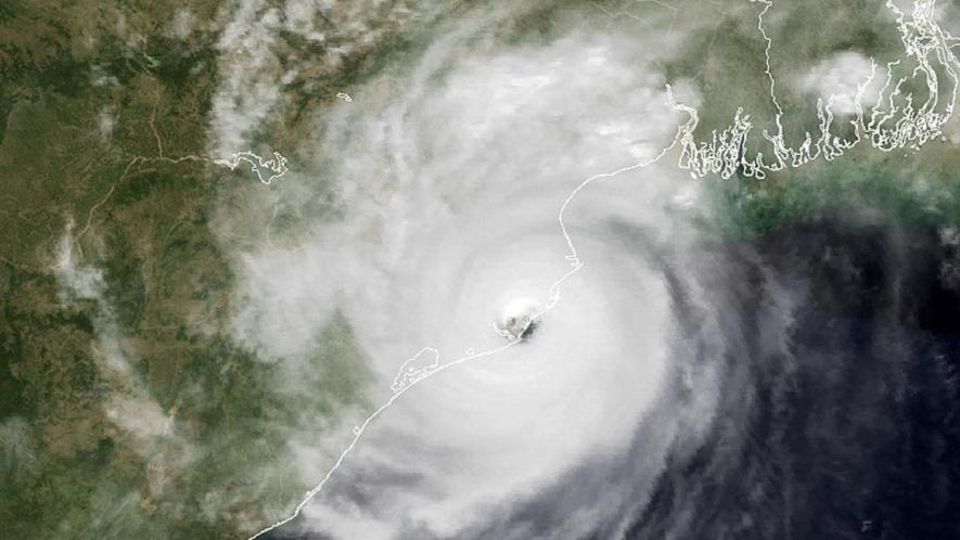
Image Courtesy: Wikimedia Commons
Cyclone Mocha over the Bay of Bengal (BOB) will likely develop into a severe storm, according to an India Meteorological Department (IMD) release on Wednesday.
Tuesday’s depression over the southeast BOB, which moved further west and northwest, will continue to move in the north and northwest direction before turning into a severe cyclonic storm by Thursday.
The storm will intensify on the same day over the southeast and central BOB. Subsequently, it will start moving in the north and northeast direction. The storm will begin losing intensity by Saturday while crossing the area between southeast Bangladesh near Cox’s Bazar and north Myanmar at Kyaukpyu with a speed of about 110-120 km/hour with gusts reaching 130 km/ hour.
The Tropical Cyclone Heat Potential (TCHP), according to the IMD, is as high as 100 kilojoules/cm square over major parts of the South Andaman Sea and the adjoining southeast and central BOB. The TCHP parameter can indicate the intensity of a tropical cyclone. It also denotes the heat in the ocean (upper part), which is a source of energy for storms. A TCHP above 100 KJ/cm2 may be high, suggesting an intensified storm.
However, the TCHP is showing a decreasing intensity of about 60-70 KJ/cm2 along India’s east coast and the Myanmar coast, the IMD said. The sea surface temperature over BOB is around 30-32 degrees Celsius.
Along with the IMD-GFS model, several other models have been observed over the cyclone system fast developing over the BOB. Other models, like the ECMWF, also suggest the same track of the cyclone system, especially the landfall point and the storm’s movement. However, models differ regarding the time and intensity of the landfall.
The cyclonic circulation formed over southeast BOB and the adjoining Andaman Sea on Sunday. Subsequently, a low-pressure region developed over the same region and intensified into a depression by Wednesday.
As per the forecast, Indian coasts will not be affected much this time as landfall occurs in the region between Bangladesh and Myanmar. However, IMD’s Wednesday bulletin, issued at 9.15 am, has warned West Bengal, Odisha, Andhra Pradesh, Tamil Nadu, Puducherry, Tripura, Mizoram and the Andaman and Nicobar governments.
The IMD has predicted heavy-to-very-heavy rainfall at many places in Andaman and Nicobar Islands and Tripura, Mizoram, Assam (southern part), Manipur, Nagaland and Arunachal Pradesh. It also predicted wind speeds of about 45-55 km/hour and gusts of 70 km/hour over the islands.
Get the latest reports & analysis with people's perspective on Protests, movements & deep analytical videos, discussions of the current affairs in your Telegram app. Subscribe to NewsClick's Telegram channel & get Real-Time updates on stories, as they get published on our website.