Pune Metro: Pillars in River Heighten Flood Risk, Will They Be Reconsidered?
Soil dumping in rivers. Photo Courtesy: https://www.punemetrorail.org/photo-gallery
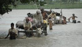
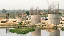
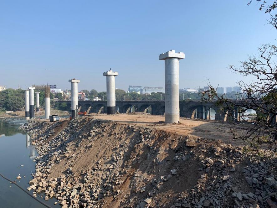
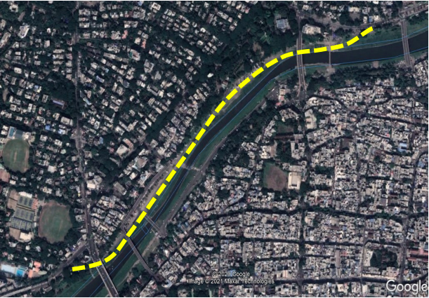
The floods of August and September 2019 claimed 22 lives in Pune city. There is a cause for worry that the now-completed construction of about 60 pillars of the Maha Metro Rail Corporation Limited (MMRCL), Pune, on the East bank of the Mutha (which is part of the Krishna River basin and flows through the heart of Pune), along 1.45 km, will cause more frequent flooding in the core city area, the most thickly populated part of Pune. The pillars have been constructed within the ‘blue line’ area, which marks the area of possible submergence if 60,000 cubic feet per second water is discharged from the Khadakwasla dam.
On January 11, 2021, Central Water and Power Research Station (CWPRS) Pune submitted a report after conducting simulation studies for water afflux from the dam, with and without the metro pillars. A 15-km stretch of the river, from Khadakwasla Dam to its confluence with the Mula river was studied for this purpose. Pune city spreads across both banks of the Mutha, and there are 16 bridges in the area that this report studied. The report estimated the spread of the afflux at each bridge, for two river discharges of 60,000 cubic feet per second and 100,000 cubic feet per second.
Computational resource developed by the US Army Corps of Engineers at the Army’s Hydrologic Engineering Centre, which is used across the world for such purposes, was used to estimate water spread. Initial simulation was for water surface elevation without the metro piers; existing bridges were incorporated in the model. Later, the metro piers and related infrastructure were introduced into the model. For discharge of 100,000 cubic feet per second, it was found that maximum afflux of 380 mm would be observed at pier number P152. An aerial survey using drones was conducted by MMRCL, given there was some discussion over the availability of only restricted cross sections of the river in the models that were used. Data from the drone survey too was used in the report.
Water spread beyond the riverbed, on account of the pillars, would reach up to 140.40 metres at the Z Bridge if 100,000 cusecs of water is released from the dam, the report states.
Prominent citizens of Pune had raised the red flag when this alignment of the metro project was first announced, arguing that the pillars would obstruct the flow of the river and cause flooding. In 2016, journalist Dileep Padgaonkar, who passed away in November that year, businesswoman Anu Aga, artist Arti Kirloskar and environmentalist Sarang Yadwadkar filed a case before the National Green Tribunal questioning this alignment.
NGT granted permission for the construction of the pillars in 2018, on the basis of a report by an expert committee assessing the impact of the pillars on flooding. The petitioners then approached the Supreme Court, where in February 2019 they proved that the expert committee had calculated the possible flooding on the basis of the wrong width of the riverbed – the committee’s assessment of the riverbed was 25% in excess of its actual size.
Also read: Chhattisgarh: Tribal Protests Intensify in Hasdeo Aranya Forest over Allocation of Land for Mining
The expert committee acknowledged the error by February 2020, blaming the MMRCL for providing it wrong data. A fresh study was then undertaken by CWPRS, and the results of this report, made available days ago, show the urgent need to realign this stretch of the metro to prevent flooding and loss of life in the city.
In a statement released to the press, Rajya Sabha MP Vandana Chavan and environmentalist Sarang Yadwadkar ask why MMRCL did not consult CWPRS earlier; why was wrong data earlier provided to the expert committee that made the assessment of the impact of the pillars; why did the expert committee not verify river width data that it had received; and why did construction of the pillars continue despite all the warnings from citizens.
Anu Aga warns that even though much money has already been spent on the pillars, the government must realign this stretch to prevent future flooding and loss of life.
The first phase of the Pune Metro project covers about 31 km, and is estimated to cost over Rs 11,000 crore. Over Rs 6000 crore of this is from a loan from the World Bank and Asian Infrastructure Investment Bank.
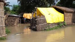
The problem of flooding in cities has been happening with increasing frequency in recent years. Himanshu Thakkar of the South Asia Network on Dams, Rivers and People, says, “The urban water sector is huge, but operates in a policy vacuum. The increasing destruction of water bodies, floodplains, mangroves, rivers and streams has happened alongside increasing paved surfaces, depleting groundwater levels and increasing pollution of rivers. Lip service is paid to rainwater harvesting, while supply is from dam-based water from long distances away. The urban construction boom also has a huge impact, with the mining of sand from the rivers. The cumulative impact of these developments coupled with the changing rainfall pattern lead to increased frequency and intensity of urban floods.”
In September 2014, Srinagar was flooded and over 250 lives were lost. Centre for Science and Environment noted that in one century, half the lakes, ponds and wetlands of Srinagar had been encroached upon. The banks of the Jhelum too had been taken over for construction, restricting the space available for natural drainage.
About a decade prior to that, on July 26, 2005, Mumbai saw 994 mm of rain in one day, and was brought to a standstill. About 1,000 lives were lost and thousands of houses were ruined. The need for the conservation of wetlands and mangroves, that may have reduced the impact of the flooding by serving as a buffer, was remarked about after that. Even so, between 1991 and 2001, about 9,000 acres of mangroves were lost. The construction of the country’s first bullet train, the Navi Mumbai International Airport and the coastal road project were all eating into mangroves.
Also read: Maharashtra's Farmers March Out Again
In the winter of 2015, Chennai witnessed heavy rain in a short spell of time and was flooded. The Comptroller and Auditor General would describe the event as a “manmade disaster” – caused by the indiscriminate discharge of water into the Adyar river. Kerala witnessed floods in 2018 and 2019, which claimed about 500 lives.
Despite the common knowledge that construction close to river banks could exacerbate flooding, such projects continue. The Central Vistal project in New Delhi will see the construction of what is called an "iconic structure" on the west bank of the Yamuna.
“It is noteworthy that there is no requirement for an independent assessment of the impact of bridges, flyovers, metro projects and roads encroaching floodplains and rivers. The cumulative impact of such interventions is huge,” Thakker points out. Increasing the bridges on a river changes the flow of the river by altering sedimentation process and the flood water spread – this could be disastrous, points out former Indian Forest Service officer Manoj Mishra, convener of the Yamuna Jiye Abhiyan.
Get the latest reports & analysis with people's perspective on Protests, movements & deep analytical videos, discussions of the current affairs in your Telegram app. Subscribe to NewsClick's Telegram channel & get Real-Time updates on stories, as they get published on our website.