Policymakers Mindset Must Change for Disaster-Free Hill Roads
Leading geologist Prof YP Sundriyal teaches the subject at the Hemavati Bahuguna Garhwal University. In this interview with NewsClick, Sundriyal, who specialises in the Garhwal region of the Himalayan range, expresses concern about the rising frequency of landslides. He believes the government must set up a special fund to maintain the slopes to stop the frequent landslides and adopt scientific norms of strengthening the fragile hillsides. Edited excerpts.
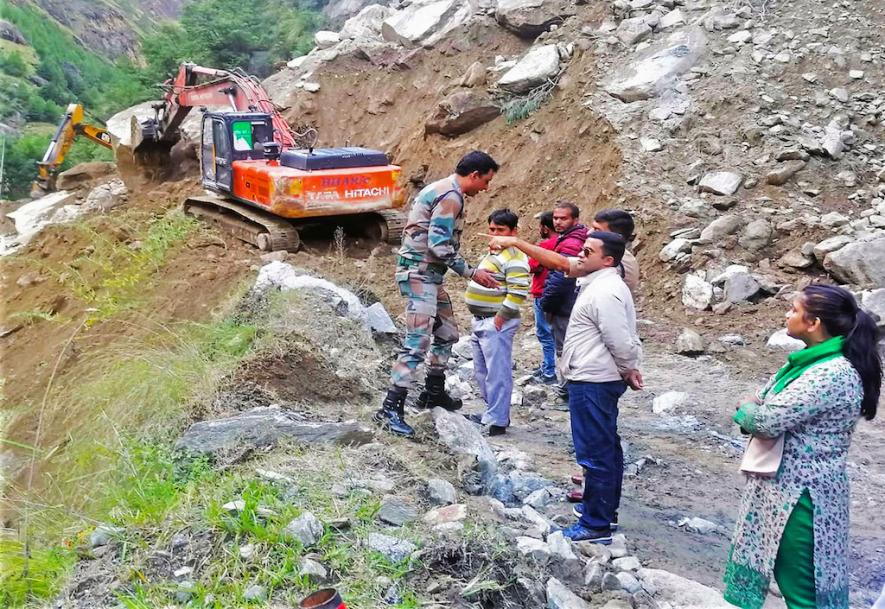
Monsoons are barely here, but a significant number of landslides have already occurred on the Char Dham road, killing several and forcing roads closed. Are the worst fears of scientists who had warned against widening this road to 10 metres coming true?
We [scientists] have been pleading that the wider the slope is cut, the more the area will destabilise. We had asked for an optimum width so vehicular traffic can ply without congestion and the slopes’ fragility is least tampered with. Since the type of rocks in [the Garhwal Himalayas] changes within short distances, uniform widening should not be applied at all. This is especially since the slopes in this region are much steeper. But no one listens to scientific reasoning. Importantly, we have funds for road-widening, but there is no provision for slope maintenance. Indeed, our fear of geologically weak and unstable areas bound to destabilise during monsoon months has been proved correct.
Uttarakhand has the highest number of unstable zones. A Department of Science and Technology report submitted to Parliament highlights that the Bhagirathi Valley alone has 235 such zones that witness frequent landslides. How is this affecting agricultural land in the State, and what are the other implications?
One of the reasons for the large and growing number of unstable slopes is the speed at which hydropower projects have been implemented. Such projects require the excavation of approach roads, tunnels and road-widening. More so, we have mighty glacier-fed rivers that carry a large quantity of sediment. Hence, the erosivity of these rivers is significantly high. That could also be responsible for the creation of a large number of unstable zones.
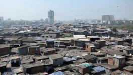
The landslide inventory map of 2021 showed the number of landslide zones in the Doon valley had crossed 100. An older IIT Roorkee study revealed that landslides increased from 20 to 100 in the last decade in the Doon valley. What are the reasons for this; could you elaborate in the context of how it impacts the people who live there?
The creation of Uttarakhand as a separate state had a large number of people migrate from the hills to settle in Dehradun. Landslides have certainly increased due to high population density and unplanned construction without following environmental safeguards. The rivers which drain through the lesser Himalayas and traverse through the Doon Valley become furious during the monsoon months. To cite an example, the Rispana river, at whose bank the state Vidhan Shabha is located, poses a severe threat to the inhabitants of Dehradun. Another major environmental concern in the Doon Valley is the excessive exploitation of groundwater and limited surface area for its recharge due to the massive increase in concrete structures.
Most landslides occur in the Garwhal region where four-laning under the Char Dham project is on in ways that are contrary to scientific advice. How can this situation be reversed?
The Supreme Court constituted a committee chaired by [environmentalist] Dr Ravi Chopra, but the majority of members inducted were from government organisations. As a result, the committee’s recommendations were not unanimous and later, the government pleaded that we needed wider roads for strategic security, and so permission [to widen the road] was granted. We don’t have any issue with widening border roads. However, no effort has been made to stabilise the slopes, which have become more vulnerable after the widening work. Even more dangerous is the practice among our planners to construct or widen roads in proximity to the floodplains of the Yamuna, Bhagirathi, Mandakini, and Alaknanda rivers.
Clearing or reconstructing damaged roads means more effort and more expenses. Further, there is a massive tourist influx in Kedarnath and Badrinath and growing numbers of accidents and fatalities. Don’t accidents and road-blocks cause delays, hamper movement and even hurt security concerns?
Certainly, I agree that unstable roads do hamper military movements. But that is why we have been arguing all along that we need disaster-free and not disaster-prone roads. During the monsoon, accidents occur every year, and many people lose their lives due to landslides. On broader roads, people drive their vehicles at high speeds, which also causes accidents.
Scientists say there is a clear link between disasters and migration. Could you explain the connection?
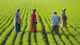
The government of Uttarakhand formed a commission to look into migration. The Palayan Aayog’s final report is an eye-opener. Not only is the rate of migration away from the hilly villages very high, but with no one left in many homes, their agricultural land has gone barren. Generally, in mountainous regions, people traditionally built villages in the middle of slopes to ensure connectivity and some element of safety. But due to acute water stress, lack of medical and educational facilities and absence of connecting roads, village people have migrated to smaller townships located over a river terrace or on the floodplain, which are very unsafe sites. During the Kedarnath tragedy, we saw how the homes of those living on floodplains were utterly destroyed and several thousand lives lost, apart from the infrastructure on the floodplains.
You are working on a major project to study the impact of climate change on the Garhwal Himalayas commissioned by the Department of Science and Technology. Could you outline some effects of climate change?
High magnitude floods and slope instability, including the number of avalanches, are rising. Due to low winter precipitation, there is a significant reduction in soil moisture. So, we are witnessing forest fires even during the autumn. Forest fires generate black carbon, which impacts glaciers by raising radiative forcing levels. Although there is no quantification, glaciers show signs of early melting (in autumn). Similarly, regarding the impact of natural springs in villages, our study indicates that the springs are drying at an alarming rate, which will adversely impact the water security of the entire Garhwal region.
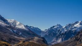
The Himalayas hold the largest volume of snow and ice outside the polar regions, are a source of major rivers, and help regulate the Asian climate. Do the changes you mention seem destructive to these roles?
That is correct. The Niti Aayog and the Uttarakhand Department of Climate Change have raised concerns about the alarming situation. The National Mission for Sustaining Himalayan Ecosystem (2017) recommended establishing an observational network for the Himalayan environment and ensuring a community-based ecosystem management model. I have no idea how far this translated on the ground. Similarly, the Uttarakhand government released its detailed study, “Uttarakhand Action Plan on Climate Change’ Transforming Crises into Opportunity’”, as far back as 2014. This document was a blueprint on how to combat the impact of climate change. Unfortunately, the same State is hell-bent on defying all the norms of strengthening the fragile Himalayas, and we see it working towards damaging the ecosystem in the most brutal manner possible.
(Rashme Sehgal is an independent journalist.)
Get the latest reports & analysis with people's perspective on Protests, movements & deep analytical videos, discussions of the current affairs in your Telegram app. Subscribe to NewsClick's Telegram channel & get Real-Time updates on stories, as they get published on our website.